The best handheld GPS to navigate anywhere in the world
Conquer the unknown with pinpoint accuracy and go-anywhere durability.
| Best Overall |
|
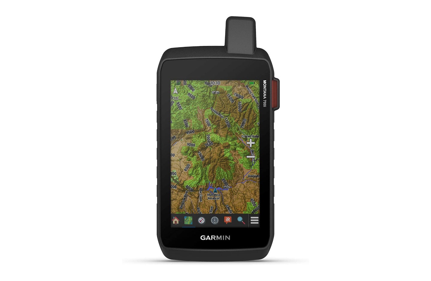
Garmin Montana 700i | SEE IT |
The Montana 700i offers unrivaled technology in a housing that’s ready for whatever you throw at it. Navigate, communicate, and get wherever you need to go. |
Pros
|
Cons
|
|
| Best Budget |
|
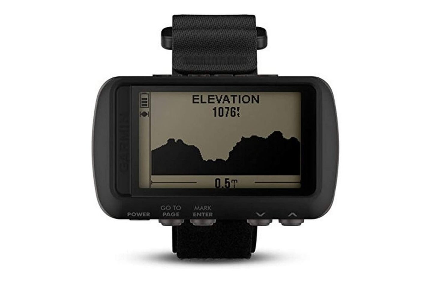
Garmin Foretrex 601 | SEE IT |
This military-tough GPS can take whatever you throw at it and even works with night vision. Best of all, it’s priced so actual service members can afford it. |
Pros
|
Cons
|
|
| Best Value |
|
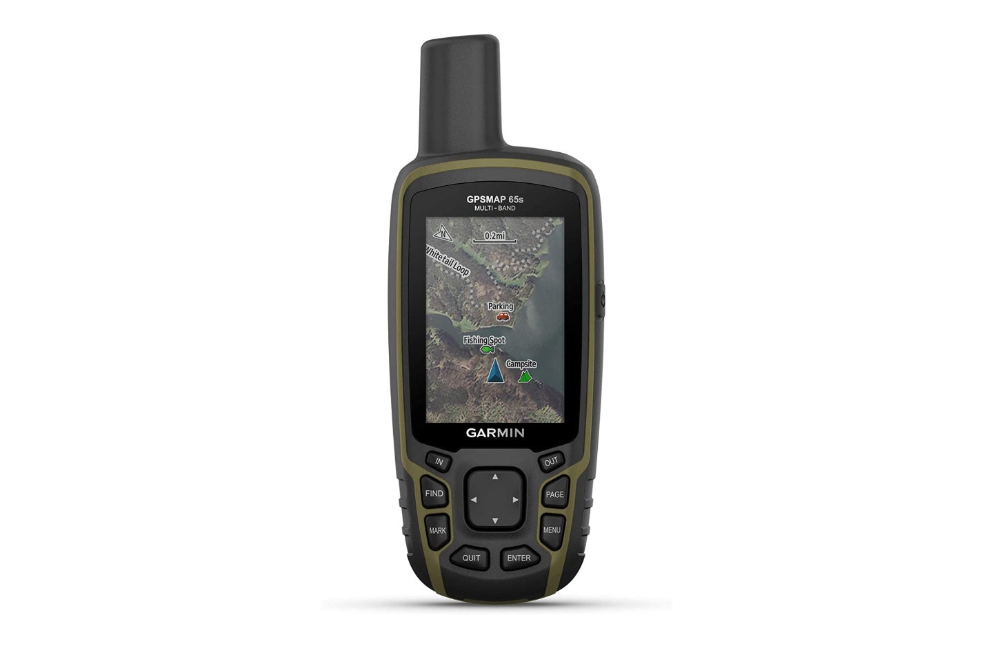
Garmin GPSMAP 65s | SEE IT |
Get a full-color display and incredibly precise location data for a reasonable price. More features are available using the Garmin Connect app. |
Pros
|
Cons
|
We may earn revenue from the products available on this page and participate in affiliate programs.
A handheld GPS unit can be a tremendous asset in the field, but you’d better know what you’re doing if you’re going to use one effectively. That starts with understanding the basics of what makes them tick and how to navigate without one.
The GPS (Global Positioning System) network includes 31 satellites owned by the United States. Alternative networks include China’s BeiDou Navigation Satellite System, the European Union’s Galileo system, Russia’s GLONASS, India’s IRNSS (Indian Regional Navigation Satellite System) and NavIC (Navigation Indian Constellation), and Japan’s QZSS (Quasi-Zenith Satellite System).
We found reliable devices that tap into a variety of these networks to bring you accurate, dependable location data all over the world. Whether you’re coordinating troop movements overseas or just finding a great hunting spot, these handheld GPS devices have you covered.
- Best Overall: Garmin Montana 700i
- Best Budget: Garmin Foretrex 601
- Best Value: Garmin GPSMAP 65s
- Best for Hunting: onX Hunt
- Best for Hiking: Garmin inReach Mini 2
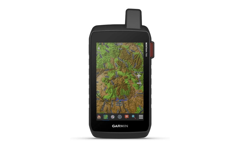
Think of something you’d use a GPS device for — the Garmin Montana 700i is probably awesome at that. It’s the best handheld GPS for people who want one device for hiking, off-roading, and driving across the country. You can save money with the Montana 700, which doesn’t have inReach satellite communication, or spend more for the Montana 750i and its built-in camera, but the Montana 700i is probably going to hit the sweet spot for most people in search of adventure or off-grid navigation.
Garmin built the Montana series of GPS devices to meet the U.S. military’s standards for temperature, impact, water, and vibration resistance. Inside the beefy housing is an incredible amount of technology. Garmin loads topographic and bird’s-eye satellite views covering North America out of the box, and you can add more maps as you travel. Public land layers can come in handy when you’re in the backcountry and need to steer clear of private land. If its navigational prowess isn’t enough, you can pair it with your phone to stay connected and monitor the weather, or link a smart collar to track your dog off-leash.
As good as this tech is, it’s not for everyone. First of all, there’s no need to pay this much if you aren’t going to take advantage of all the Montana 700i’s features. There are much more affordable ways to accomplish basic navigation on this list. Second, the touchscreen is big and beautiful, but there are times when physical buttons are preferable. I’ve seen cases of people having trouble with the touchscreen in extremely hard rain, so that might be something to consider. Otherwise, this thing is a beast and it’ll probably be the only GPS you need.
- Satellites: GPS, Galileo
- Battery life: More than a week (in Expedition Mode)
- Memory: 16 gigabytes internal, 32 additional gigabytes in a removable SD card
- This was an easy choice; Garmin makes the best handheld GPS navigation systems and the Montana 700i is the best Garmin. If you have the money, your search ends here.
Add map layers for public lands, marine navigation, and more
Offers topographic maps and satellite imagery
Expedition Mode stretches battery life beyond a week
Subscription required to unlock the full potential
You can find a lot of handheld GPS devices for less than $700
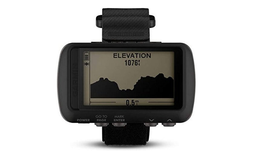
The Garmin Foretrex 601 can be used as a handheld GPS or you can mount it to your wrist, plate carrier, or the shoulder straps of your pack. It’s the most old-school option here and represents an easy-to-learn option for service members who need the basics without a bunch of expensive add-ons.
One of our writers used the Foretrex for several weeks at the Marine Corps’ Integrated Training Exercise at Marine Corps Air Ground Combat Center Twentynine Palms and found it to be a worthwhile piece of gear. It can do all the things you probably need from a GPS, including navigating to waypoints using MGRS or latitude and longitude, estimating distance, and predicting sunrise, sunset, moonrise, and moonset. In a military environment, you’ll also appreciate the impressive battery life and compatibility with night vision devices.
The downsides of this budget GPS unit come from cost-cutting. It can handle life in the field, but it won’t necessarily be pretty. Expect dings and scratches, especially on the screen. You might want to invest in a protective case. It’s not as precise as an issued GPS, doesn’t display time in seconds, and — while there is a compass — the lack of a sighting mechanism makes it difficult to get an accurate azimuth. If you’re already using a compass map, this is a serious asset. If you want a do-it-all solution, spend a little more on one of our other picks.
- Satellites: GPS, GLONASS, Galileo
- Battery life: 48 hours (with GPS active)
- Memory: Not specified
- This simple, sturdy, old-school GPS unit is ready for duty in a military environment. Save money and get down to business by opting out of features you don’t need.
Simple controls almost eliminate the learning curve
Does everything you need to navigate accurately
Screen is easy to read in sunlight or with NVGs
Compass lacks a sighting mechanism to shoot an azimuth
Old-school display is a clear cost-saving measure
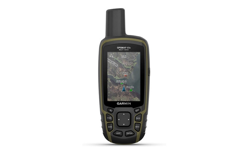
Sometimes the Garmin GPSMAP 65s gets passed over for more flashy or more affordable options, but it’s one of the best values in the handheld GPS market and it’s incredibly well-suited to life in the military. What it lacks in bells and whistles it more than makes up for in precision, durability, and ease of use. Being relatively easy on the wallet is a nice perk, too.
Right off the bat, you’ll notice that the screen is much smaller than the one on the Montana 700-series units. That’s partially because this device is smaller overall, but it’s also because the GPSMAP 65s makes room for physical buttons. This makes the GPSMAP65s a little more durable and easier to use in harsh environments. Even though it doesn’t max out the price range, Garmin touts this as its most precise GPS unit yet. It can access satellites from four different networks simultaneously to provide accurate location data even in challenging terrain like urban areas, canyons, and dense forests. That doesn’t make a real-world difference for casual hikers, but in a military setting, it could give you a meaningful edge.
The features and interface of this handheld GPS will feel boiled down compared to something like the Montana 700i, but it has everything most people need. Given the accuracy advantage and physical buttons, it might be even better for use in the military. The fact that it takes two AA batteries also makes replacements readily available for those of you looking for a worst-case scenario navigation option.
- Satellite: GPS, GLONASS, Galileo, QZSS
- Battery life: 16 hours
- Memory: 16 gigabytes
- This is one of the most accurate handheld GPS devices you can get. It’s weatherproof and offers full-color topographic maps. How it costs less than $400 is beyond us.
Tap into four satellite networks for incredible accuracy worldwide
Stay in command with the large, color display
Unlock even more features with the Garmin Connect app
Takes some time to master all the capabilities
A rechargeable battery would be nice
onX Hunt
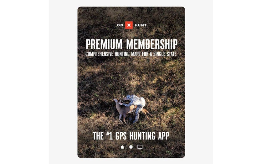
Don’t sell onX Hunt short just because it’s an app rather than a standalone GPS device. This is one of the most powerful hunting tools on the market, and it could very well revolutionize the way you take care of business year-round.
When you head out the door to scout a new area or set up for an early morning of hunting, you can use GPS imaging to see a bird’s-eye view of the land around you like you would using any number of navigational aids. The onX Hunt app can overlay boundaries to show which land is private and which is public. In the case of private land, it can even show you who owns it and help you get in touch with them to ask permission to hunt on their land. Want more? This app can show you where certain tree and crop species are found to help you identify the places game animals might be.
Of course, it also offers the usual topographic overlays, route planning, weather forecasting, and waypoint sharing. It does involve a monthly fee that goes up significantly if you want to use this app in more than one state, but you don’t have to buy a new device and you can access more detailed maps on your computer for more detailed planning. There’s a lot to take in, so take advantage of the free seven-day trial to see what the fuss is all about.
- Satellites: Depends on your device
- Battery life: Depends on your device
- Memory: Depends on your device
- This app is full of features that would have sounded like science fiction a few years ago. Access your route, property lines, and data on game animals in real-time.
Easy to use since it operates on your smartphone
See public and private land boundaries
Packed with hunting-specific features
Relies on your smartphone’s GPS
Gets pricey fast if you want to use it in more than one state
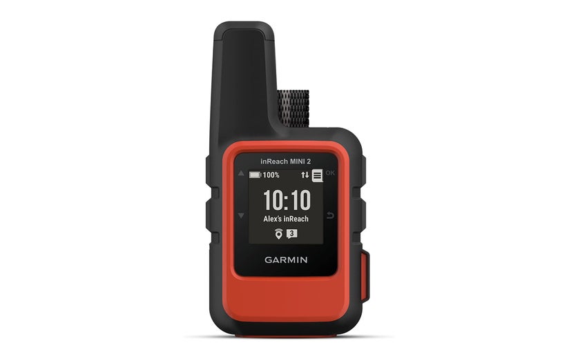
It’s easy to see why the Garmin inReach Mini gained such rapid popularity, and the second iteration is even better. This handheld GPS unit is light and compact, making it perfect for backpackers and hikers who keep an eye on every ounce. What it lacks in visual detail it makes up for in portability, ease of use, and double-duty as a satellite communicator.
Compared to the original inReach Mini, the inReach Mini 2 has longer battery life, a USB-C port instead of Micro-USB, storage for 1,000 waypoints instead of 500, TracBack routing to return to your starting point, compatibility with the Garmin Explore app, and access to more satellite networks. While its predecessor relied solely on the GPS network, the new inReach Mini 2 can also tap into the Galileo, QZSS, and BeiDou networks to keep you on track in more places around the globe.
There’s a lot to love about the inReach Mini 2. One consequence of its tiny size is a simple black-and-white display that’s less than one-inch square. It can give you accurate point-to-point directions, but you won’t be able to access topographic maps without pairing it to your phone and using the Garmin Explore app. The satellite communication function is a huge asset to have outside of cellular service, but it does require a paid subscription. If you’re a serious backpacker, the pros will outweigh the cons and this is almost definitely the GPS for you.
- Satellites: GPS, Galileo, QZSS, BeiDou
- Battery life: Up to 30 days (using a 30-minute tracking interval)
- Memory: Not specified
- When you want to stay light and move fast, this tiny handheld GPS unit can keep you on track and in touch with the rest of your group.
Super light and compact
Use satellite messaging and the emergency signal anywhere in the world
Let the TracBack feature guide you home
Satellite messaging requires a subscription
Small, simple display provides minimal detail
Things to consider before buying a handheld GPS
Modern handheld GPS navigation systems are very capable, but some are better suited to certain tasks than others. Are you following a trail into the wilderness, finding grid coordinates on a map, or looking for a reliable safety net that can bring you back to the trailhead in a pinch? Once you understand the following factors, you’ll be equipped to choose the best handheld GPS for you.
Satellite networks
GPS has become a ubiquitous term for any kind of digital navigation, but reality is a little more complicated than that. A more accurate term would be GNSS, or global navigation satellite system. This catch-all category includes all satellites used to provide location data.
In most cases, handheld GPS devices designed to work with the U.S. network are able to access other networks, as well. This may not translate to greater accuracy in the U.S., but it will eliminate blind spots and allow you to get accurate readings around the world.
GNSS options include:
- GPS (United States)
- Galileo (European Union)
- GLONASS (Russia)
- QZSS (Japan)
- IRNSS and NavIC (India)
- BeiDou Navigation Satellite System (China)
Memory and waypoints
Once you know where you are in the world, your next step is probably going to be plotting a route to your destination. That usually involves a series of waypoints, and some GPS units can do that better than others. Most manufacturers will specify how many waypoints can be stored. That number will be dictated by how much internal memory the device has.
Altitude, barometer, and compass
The satellites that support your GPS device can determine your altitude, but an onboard barometer can improve accuracy. It can also monitor changes in air pressure to help you monitor the weather and prepare for incoming storms. A built-in compass can be very useful for orienting yourself and moving on the fly. Sight-and-go navigation provides the speed of glancing at a lensatic compass with the accuracy of GPS.
Messaging
Satellite communicators and personal locator beacons can be used anywhere in the world and are not reliant on cellular networks or data plans. That makes them invaluable for people working in remote areas. Some handheld GPS devices incorporate this feature and can even exchange location data with other users. Be aware that this service isn’t cheap; you’ll need to pony up cash for a subscription to take advantage of this capability.
FAQs about handheld GPS
Q: How much does a handheld GPS cost?
A: Garmin is the brand to have in the GPS world, and its most affordable unit costs $110. Handheld GPS prices go up to $800 for the Montana 750i or GPSMAP 276Cx.
Q: Which handheld GPS is the most accurate?
A: All of the handheld GPS devices on this list are very accurate. What varies is the source of that positional information — there are other satellite networks besides GPS. The Garmin GPSMAP 65s can communicate with four satellite networks, which is the most of any product here and should provide the broadest coverage.
Q: What is the easiest handheld GPS to use?
A: The easiest handheld GPS for beginners is probably the phone you use every day. Standard navigational tools like Google Maps, Apple Maps, and Maps.me are fine for everyday use but they aren’t great outside city limits. If you want to experiment with handheld GPS on a budget, check out the Gaia GPS app.
Final thoughts
The Garmin Montana 700 series is the best you can get right now. Whether you prioritize outright navigating power, detailed maps, long battery life, or physical toughness, this handheld GPS has you covered. If you can afford the premium price tag, you’ll end up with an undeniably capable piece of gear.
Methodology
As much as I trust and respect Garmin, I went out of my way to look for alternative brands that might get overlooked based on name recognition. The truth is that no other manufacturers can really go toe-to-toe with Garmin at the moment.
With that established, I conducted a virtual Garmin handheld GPS comparison to determine which ones were best for use in a military environment. I wanted to find products that you can trust in the field, then use to explore the world on your own time. Durability was obviously important in this process, but so was global usability. Finally, I looked for products across the price range because you shouldn’t have to choose between the very best or nothing. There are great handheld GPS units for every budget, and that’s what you see here.