
Nearly 80 years ago, American forces launched a successful invasion of Guam. The island had fallen into Imperial Japanese control in 1941, just one day after the attack on Pearl Harbor, and as the United States military worked to take the war to Japan, U.S. troops slowly but surely captured island after island in the Pacific. Eventually, that island-hopping campaign reached Guam.
Today, a team of scientists with the National Park Service is in the middle of a major survey of the battle site, searching for artifacts from the battle. The expedition, titled “Guam: A Biogeographic and Maritime Cultural Landscape Exploration of a World War II Amphibious Battlefield” and run by the National Park Service with funding from a grant from the National Oceanic and Atmospheric Administration, started on Jan. 27 of this year with an initial survey.
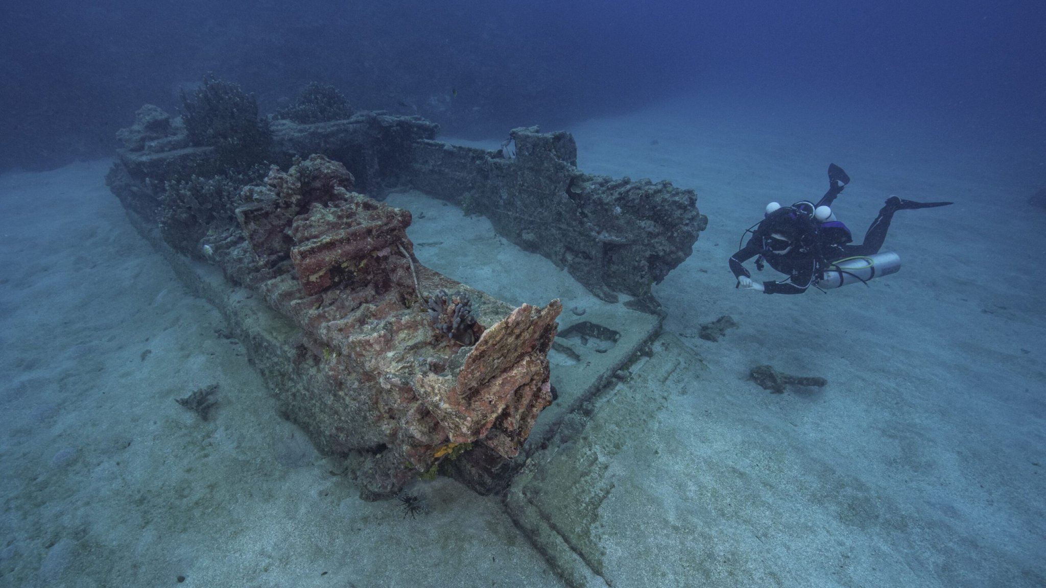
The purpose of the research is two-fold: ocean archaeologists are mapping the site around two landing beaches to chart the damage to the coral reefs, but also searching for any potential remnants from the fighting during World War II, such as shipwrecks, amphibious landing vehicles, and artillery pieces.
Subscribe to Task & Purpose Today. Get the latest military news, entertainment, and gear in your inbox daily.
“Guam was invaded the day after Pearl Harbor and not many people know that,” said Monique LaFrance Bartley, co-principal investigator on the project and a marine ecologist with the National Park Service
On Dec. 8, 1941, a landing force of 5,900 Japanese infantry attacked Guam, a U.S. territory. Over three days the invading troops defeated a small American garrison and fighters from the indigenous Chamorro people. Guam would remain in Japanese hands until August 1944.
In response to the attacks on Pearl Harbor and Guam, the United States launched Operation Forager, the campaign to capture the Mariana and Palau islands. A force of more than 65,000 troops took part, assaulting two landing zones at the Agat and Asan beaches. After nearly three weeks of fighting, the American troops won, with nearly 3,000 of their own killed.

Since World War II, the battle sites at Guam have been turned into the War in the Pacific Historical Park, under the National Park Service. However, there had not been a survey of the waters around the island. A few items had been identified, but nothing that covered the entire battlefield.
Ahead of setting out for Guam, the team researched documents in the National Archives from World War II about the operation. Anne Wright, an ocean archeologist with the NPS and principal investigator for the expedition, found an underwater dive team’s map from the battle, which noted every demolition mark — “X” marked several spots in this case, as well as landing obstacles set up along the beach. Wright was able to georectify the hand-drawn map, putting it on a grid that the team could use to search the waters.
The Guam expedition follows a similar one at Peleliu conducted by underwater archaeology non-profit Ships of Discovery and funded by NOAA in 2018, which also looked at remnants and artifacts from fighting there in World War II.
Part of the expedition is to get a record of the area before sea level rise and climate change alter the environment, LaFrance Bartley, the co-principal investigator, said. Another aspect is to study just how the coral reefs around Guam were damaged and how they’re recovering. During the island-hopping campaigns of the Pacific Theater, American troops ran into trouble with the islands themselves. At the invasion of Tarawa in November 1943, Amtracs and other vehicles got caught in coral reefs, forcing troops to exit rapidly and leaving many to die from drowning or enemy fire. The U.S. military started looking for solutions, including blowing up parts of the reefs to let landing vehicles pass.

That was done at Peleliu. Explosives were set directly on the coral and detonated. The previous survey of that battle site did a coral analysis there and found that the coral populations of the blasted areas were larger and more diverse than the undamaged places, Wright said. A strong coral reef can help protect islands from severe storms, a concern as climate change brings more intense weather around the planet.
To survey the waters around Guam, the team is using a suite of tools. Those include a magnetometer, side scan sonar, and the SeaArray, a photogrammetry system that was custom-built for the National Park Service. The waters around Guam are also fairly unique; the initial area near the reefs is quite shallow — almost knee deep according to the team — but the ground quickly drops out at a certain point. For the expedition, the team has a clear area around each landing beach for which to search. Asan Beach has a 2.8 x 1.1-kilometer search area, while at Agat Beach, it’s 3.4 x 0.7 kilometers.
So far the research team cannot say how many artifacts they’ve found just yet. The team found an aircraft piece at Agat Beach, which might have been an isolated artifact or part of a larger find.
The expedition team will return to Guam for a follow-up survey in July, running into August. The research will feature more diving and scans, looking at the points of interest marked earlier this year, as well as going into the deeper water off the island. For those interested in following along, the research team plans on posting blogs with updates on the expedition on the NOAA website. When the next trip wraps, the team expects to have their findings by September.
The latest on Task & Purpose
- No, the VA isn’t going to reduce your disability payments if you make too much money
- Air Force 1-star general relieved for ‘shortfalls’ in personal conduct
- What are America’s goals in Ukraine? It’s not totally clear
- Russia is dusting off ancient tanks as losses mount in Ukraine
- How the Battle of Nasiriyah foreshadowed the long slog of the Iraq War
