Tyndall Air Force Base suffered widespread destruction from the effects of Hurricane Michael, as satellite photos show.
NOAA released overhead imagery from the path of Michael, and when compared to images taken from Google Earth, it’s clear that Tyndall has a long way to go toward being restored. Across the base, buildings are missing roofs, vehicles are strewn about, and debris is just about everywhere.
In this photo from Google Earth, you can see a baseball diamond in the right, and what looks like a barracks toward the middle. To the left is a parking lot for RVs and boats.
Google Maps

Here’s what it looks like now. The parking lot is a mess, and large sections of the barracks roof are missing:
NOAA

Just up the street is Building 1149, another building for housing:
Google Earth

Here’s what it looks like now:
NOAA

Here you can see the main base exchange and other restaurants for the base:
Google Earth

Now it appears the storm deposited a large amount of water on top of the exchange building, while winds pulled parts of the roof off the Class Six convenience store and the Raptor Lanes bowling alley in the lower right.
NOAA

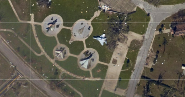
The storm was so powerful that a display of decommissioned aircraft …
Google Maps

… Was knocked over, and the area was littered with debris.
NOAA

Closer to the flight line are aircraft hangars:
Google Maps

Damage to this one was catastrophic:
NOAA

Here’s a much larger area of the flight line and buildings next to it:
Google Maps

Which, unfortunately, didn’t fare much better:
NOAA

WATCH NEXT: